San Antonio Hot Springs
Checked October 2026 · Sources
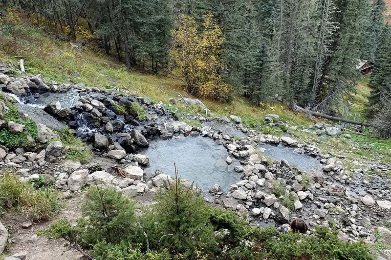
.jpg)
San Antonio Hot Springs is a wild soak in the Santa Fe National Forest, New Mexico, about 108 minutes' drive from Santa Fe: 129 F water at the source (1980 survey), a 0.3-mile walk from the nearest road, snow likely November to May.
- Wild
- Walk 0.3 mi
about 1 h 48 min
68.6 mi from Santa Fe, no traffic
Drive times computed with GraphHopper; map data OpenStreetMap contributors.
The facts
- Water
- 129 F at the source, not the poolQuoted from the NOAA Thermal Springs List, checked Oct 11, 2026 (1980 survey), entry SAN ANTONIO HOT SPRING
- Walk
- 0.3 miles one way from the nearest roadComputed on an OpenStreetMap foot route · start 35.93681, -106.64231
- Fee
- Not posted by the agencyChecked on the Forest Service, checked Oct 12, 2026
- Permit or reservation
- None posted by the agencyChecked on the Forest Service, checked Oct 14, 2026
- Clothing
- Not posted by the agencyChecked on the Forest Service, checked Oct 11, 2026
- Dogs
- Not posted by the agencyChecked on the Forest Service, checked Oct 11, 2026
- Snow
- Likely November to MayComputed from NOAA snowfall, 2023 to 2026 seasons
- Managed by
- USDA Forest Service, Santa Fe National Forest
- Last checked
- October 2026
Trail and trailhead
Road access
The Forest Service says:
"Access via a 0.7-mile out and back trail."
Quoted from the Forest Service, checked Oct 14, 2026
- Distance
- 0.3 mile one wayComputed on an OpenStreetMap foot route
- Climb
- About 20 ft up and 390 ft down, one wayComputed from USGS 3DEP elevations at 14 points on our route, Oct 14, 2026 (rough)
- Start
- Road access35.93681, -106.64231
Water temperature
129 F at the source, from NOAA's Thermal Springs List (1980 survey). That is where the water leaves the ground; the pool you sit in is cooler.
Quoted from the NOAA Thermal Springs List, checked Oct 11, 2026 (1980 survey), entry SAN ANTONIO HOT SPRING
Fees and rules
Do you have to pay to go to San Antonio Hot Springs?
Not posted by the agency.
Checked on the Forest Service, checked Oct 12, 2026
Do you need a permit or reservation for San Antonio Hot Springs?
None is posted. not posted
Checked on the Forest Service, checked Oct 14, 2026
Clothing and dogs
Not posted by the agency.
Checked on the Forest Service, checked Oct 11, 2026
Not posted by the agency.
Checked on the Forest Service, checked Oct 11, 2026
Seasons and winter access
Snow likely November to May at the spring.
Computed from NOAA snowfall, 2023 to 2026 seasons
Road and gate closures: check Forest Service alerts, Santa Fe National Forest.
Before you go
- No permit or reservation is posted.
- Snow likely November to May.
- Check Forest Service alerts, Santa Fe National Forest before you drive.
Getting there
Drive times from each town's center, no traffic (computed).
Both open at the start, the road access point, not at the pool.
Nearby hot springs (6)
Questions
Is San Antonio Hot Springs free?
How long is the hike to San Antonio Hot Springs?
Is San Antonio Hot Springs clothing optional?
Can I bring my dog?
Sources and last checked
Page last checked October 2026 (the oldest date below).
- ncei.noaa.gov/access/metadata/landing-page/bin/iso: water temperatureChecked Oct 11, 2026
- fs.usda.gov/r03/santafe/recreation/san-antonio-hot-springs: fee (not posted), clothing (not posted), dogs (not posted), trailChecked Oct 11, 2026 and Oct 12, 2026 and Oct 14, 2026
- Walk: 0.3 mi, computed on an OpenStreetMap foot route (FOSSGIS routing, foot profile) from 35.93681, -106.64231Map data OpenStreetMap contributors, ODbL
- Drive times from Santa Fe, Albuquerque, Taos: computed with GraphHopper 11.1, car profile, no trafficOpenStreetMap extract of Oct 12, 2026
- Snow months (Nov, Dec, Jan, Feb, Mar, Apr, May): computed from NOAA snowfall, 2023 to 2026 seasonsMethod page explains the rule
- Climb: computed from USGS 3DEP elevations along our OpenStreetMap foot routeComputed Oct 14, 2026
- Photo: John Fowler from Placitas, NM, USA, Wikimedia Commons, CC BY 2.0Checked by eye Oct 12, 2026